
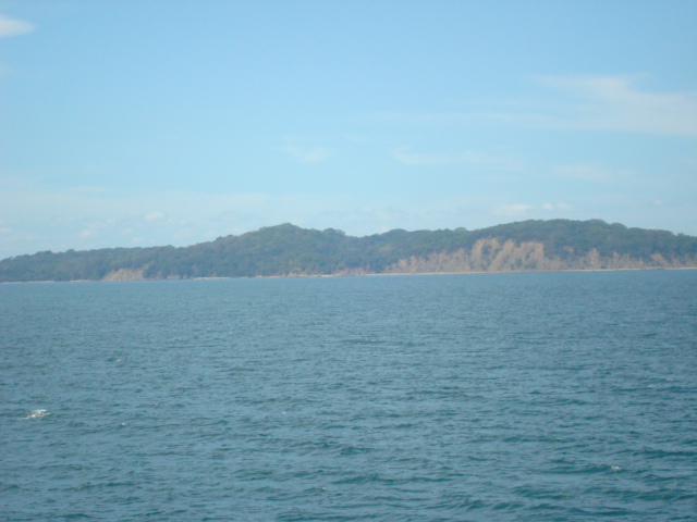
San Lucas Island National Park
Parque Nacional Isla San Lucas
Added by
Anonymous Curator
Reviewed by
Under Review
Last modified by
Julia Trouin
Description
Located in the heart of the Gulf of Nicoya, San Lucas is Costa Rica's 30th national park. It is a unique destination that merges the historical memory of its former prison with a dry forest ecosystem in the process of regeneration. Its trails pass through the ruins of cells and the old pier, offering a moving experience about freedom and conservation amidst unparalleled marine scenic beauty.
ClassificationAdministrative and legal categories that govern how this area is managed and protected.
HistoryHistorical background, founding story, and timeline of legal protection designation.
San Lucas housed the country's most famous prison between 1873 and 1991. Known as 'the island of lonely men,' its walls still preserve graffiti and drawings by inmates that tell of the suffering and hope of those confined there. The famous Costa Rican writer José León Sánchez wrote his masterpiece, 'The Island of Lonely Men,' based on his experiences as a prisoner here. In 2020, it was upgraded to a National Park to protect this cultural heritage and its growing biodiversity.
Surface AreaTotal surface area subdivided by terrestrial, marine, and buffer zones in hectares.
Entry FeesEntry fee structure for Costa Rican residents and international visitors, in CRC and USD.
Entry exclusively via digital purchase on the SINAC website. Maritime transport and guide costs are paid separately to Puntarenas tour operators.
EcosystemsVegetation communities and ecosystem types present within this protected area.
The island has a recovering tropical dry forest ecosystem. Being a volcanic island in the gulf, it features sandy beaches, rocky cliffs, and a mangrove area. The vegetation consists of species resistant to salinity and summer drought, creating a critical habitat for marine connectivity in the Gulf of Nicoya.
WildlifeNotable fauna and flora documented through scientific surveys and long-term monitoring.
Despite its past, today it is a sanctuary for howler monkeys, white-tailed deer, squirrels, and armadillos. It is an excellent site for spotting birds like frigatebirds, brown pelicans, and sunbitterns. Its surrounding waters are rich in parrotfish, snappers, and occasionally dolphins and whitetip sharks are spotted in the gulf surroundings.
How to Get ThereHow to reach this protected area by road, public bus, boat, or guided tour.
Access EXCLUSIVELY by sea. Boats depart from the Puntarenas pier (approx. 30 min) or from Paquera. There are authorized tour operators offering full guided tours. You must reserve your digital entrance ticket before boarding the vessel.
ClimateTypical weather patterns, temperature ranges, and seasonal rainfall affecting this location.
Tropical dry climate, hot and sunny. Temperatures range between 26°C and 34°C. The dry season (December-April) is ideal for walking historical trails without mud and enjoying the gulf's marine breeze.
Visitor RegulationsVisitor rules and restrictions designed to protect the natural heritage of this area.
Single-use plastics and cigarettes are prohibited. Touching or removing stones or fragments from the historical ruins is not allowed. Closed footwear is mandatory (there are trails with thorny vegetation). Entering ruin areas not opened to the public is strictly forbidden due to structural collapse risks. Feeding wildlife is not allowed.
Best Seasons to Visit
Regions
Facilities & ServicesInfrastructure and services available: ranger stations, restrooms, parking, and lodges.
HighlightsDistinctive features and attractions that make this protected area exceptional.
Main ThreatsDocumented pressures reducing the population: habitat loss, hunting, disease, climate change, and invasive species.
- Deterioro estructural de las ruinas históricas
- Vandalismo en grafitis antiguos
- Pesca ilegal en los alrededores
- Escasez de agua dulce en la isla
ConservationActive programs and initiatives working to protect and restore this habitat or area.
- Restauración y consolidación de edificios históricos
- Programa de manejo de desechos y energía solar
- Vigilancia conjunta con guardacostas
- Educación histórica y ambiental