
Corcovado National Park
Parque Nacional Corcovado
Added by
Anonymous Curator
Reviewed by
Under Review
Last modified by
Gerardo Venegas
Description
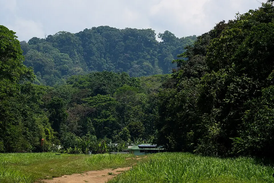
Corcovado National Park is one of the most biodiverse places on Earth, located on the Osa Peninsula in southwestern Costa Rica. Often described by National Geographic as "the most biologically intense place on Earth," it protects the largest expanse of lowland tropical rainforest on the Pacific coast of Central America. The park is home to all four of Costa Rica's monkey species, two of its crocodilian species, and an extraordinary density of jaguars, tapirs, and scarlet macaws.
ClassificationAdministrative and legal categories that govern how this area is managed and protected.
HistoryHistorical background, founding story, and timeline of legal protection designation.
Established on October 31, 1975, Corcovado was created in response to rapid deforestation and gold mining that threatened the Osa Peninsula's forests. The park displaced several hundred subsistence farmers and gold miners (oreros) who had settled in the area. In 1980 it was designated a UNESCO World Heritage candidate. Conservation efforts intensified in the 1980s and 1990s with international NGO support, and today it stands as one of the most successful conservation projects in Latin America.
Surface AreaTotal surface area subdivided by terrestrial, marine, and buffer zones in hectares.
Entry FeesEntry fee structure for Costa Rican residents and international visitors, in CRC and USD.
Advance reservation required through SINAC. Camping at Sirena Station is booked separately (approx. $8/night for nationals, $12/night for foreigners). Children under 6 enter free.
EcosystemsVegetation communities and ecosystem types present within this protected area.
Corcovado encompasses at least eight distinct ecosystems: lowland tropical rainforest, montane forest, cloud forest, mangrove forest, palm swamps (yolillo), herbaceous swamps, beaches, and marine environments. The park receives over 5,500 mm of annual rainfall, making it one of the wettest regions in Costa Rica. Its rivers—including the Río Sirena, Río Claro, and Río Madrigal—drain into the Golfo Dulce.
WildlifeNotable fauna and flora documented through scientific surveys and long-term monitoring.
The park shelters an extraordinary array of wildlife. All four of Costa Rica's monkey species (spider, howler, white-faced capuchin, and squirrel monkey) are found here. Large mammals include the Baird's tapir, jaguar, puma, ocelot, giant anteater, and white-lipped peccary. The coastline supports nesting populations of four sea turtle species. Over 500 bird species have been recorded, including the scarlet macaw, harpy eagle, and the endemic black-cheeked ant-tanager. Whale sharks and humpback whales are frequently observed in the adjacent Golfo Dulce.
How to Get ThereHow to reach this protected area by road, public bus, boat, or guided tour.
Corcovado is accessible via three main entry points: La Leona (from Carate, reachable by 4x4 or charter flight), Los Patos (from La Palma), and San Pedrillo (by boat from Drake Bay or Sierpe). The Sirena Biological Station, the park's core research hub, is reached by a 3–4 hour hike from La Leona or by charter flight from Palmar Sur or Puerto Jiménez. No roads connect to Sirena. Advance reservations through SINAC are mandatory for all sectors.
ClimateTypical weather patterns, temperature ranges, and seasonal rainfall affecting this location.
Hot and humid year-round. Temperatures range from 23°C to 33°C. Average annual rainfall exceeds 5,500 mm, with a relatively drier period from December to April. The wettest months are September and October, when trails can become impassable. Humidity is typically above 85%.
Visitor RegulationsVisitor rules and restrictions designed to protect the natural heritage of this area.
All visitors must make advance reservations through SINAC. Maximum daily capacity is 180 visitors in the Sirena sector and 35 per sector for Los Patos, San Pedrillo, and La Leona. Camping is only permitted at Sirena and must be reserved separately. No single-use plastics are allowed inside the park. Visitors must be accompanied by a certified local guide in all sectors. Drones are strictly prohibited. Swimming in rivers is discouraged due to bull sharks and crocodiles.
BiodiversitySpecies count statistics from scientific surveys and long-term monitoring programs.
TrailsMarked hiking trails open to visitors, including the total network distance in kilometres.
Best Seasons to Visit
Regions
Facilities & ServicesInfrastructure and services available: ranger stations, restrooms, parking, and lodges.
HighlightsDistinctive features and attractions that make this protected area exceptional.
Main ThreatsDocumented pressures reducing the population: habitat loss, hunting, disease, climate change, and invasive species.
- Illegal artisanal gold mining (oreros) causing river sedimentation and mercury contamination
- Deforestation and agricultural encroachment in the buffer zone on the Osa Peninsula
- Poaching of jaguars, tapirs, and sea turtles by organized wildlife trafficking networks
ConservationActive programs and initiatives working to protect and restore this habitat or area.
- Joint patrol program between SINAC rangers and Sea Shepherd Conservation Society to combat illegal fishing in the adjacent marine zone
- Community-based ecotourism model linking local guides and lodges to park revenue, reducing incentives for extractive activities
- Long-term jaguar monitoring program using camera traps, in collaboration with Panthera and the Osa Conservation organization
GalleryPhotographs of this species or habitat in its natural environment.
Bibliographic ReferencesScientific publications, field guides, and databases that document this species or area.
- Janzen, D.H. (1983). Costa Rican Natural History. University of Chicago Press.
- Frankie, G.W. & Mata, A. (2000). Biodiversity of Guanacaste and Corcovado. INBio.