
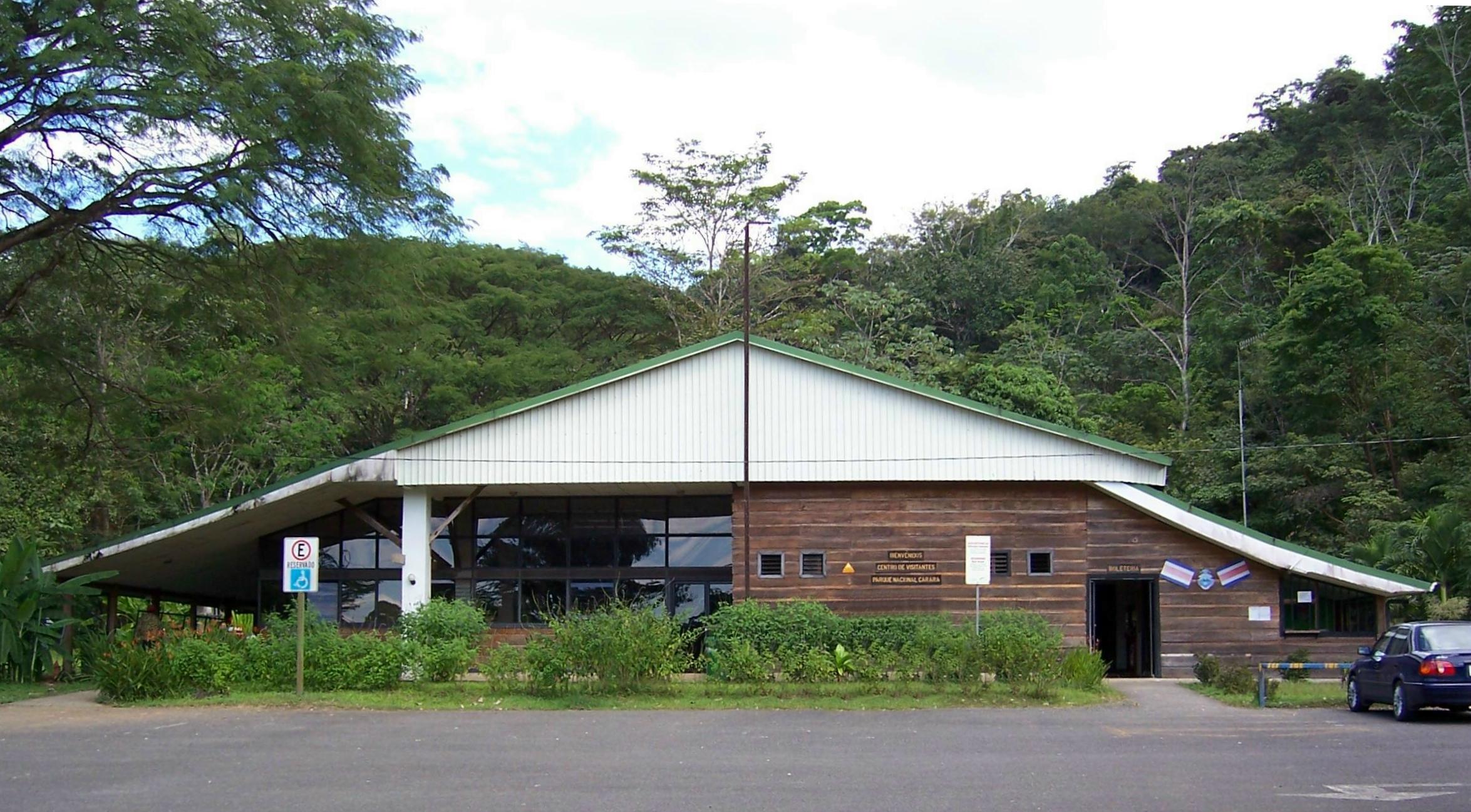
Carara National Park
Parque Nacional Carara
Added by
Anonymous Curator
Reviewed by
Under Review
Last modified by
Julia Trouin
Description
Located in the Grande de Tárcoles River basin, Carara is an exceptional biological laboratory. It represents the transition zone where species from the North Pacific dry forest and the South Pacific very humid forest converge. This unique confluence generates extraordinarily high biodiversity, making it a world-class destination for birdwatching and the study of changing ecosystems.
ClassificationAdministrative and legal categories that govern how this area is managed and protected.
HistoryHistorical background, founding story, and timeline of legal protection designation.
Originally established as a Biological Reserve in 1978, Carara was upgraded to National Park status in 1998 to allow for better management of increasing tourist flow and to protect its vital resources. The name 'Carara' comes from the indigenous Huetar word meaning 'Crocodile River', reflecting the close relationship between the forest and the adjacent Tárcoles River.
Surface AreaTotal surface area subdivided by terrestrial, marine, and buffer zones in hectares.
Entry FeesEntry fee structure for Costa Rican residents and international visitors, in CRC and USD.
Mandatory card payment at the entrance. It is recommended to hire certified guides to maximize bird sightings and understand transition forest dynamics.
EcosystemsVegetation communities and ecosystem types present within this protected area.
It protects the last vestige of transition forest in the Costa Rican Pacific. It houses primary forests with very tall trees (up to 50 meters), secondary forests in active regeneration, and extensive wetlands and mangroves at the mouth of the Grande de Tárcoles River, which are critical for the reproduction of marine and freshwater species.
WildlifeNotable fauna and flora documented through scientific surveys and long-term monitoring.
It is famous for harboring one of the country's largest colonies of Scarlet Macaws (Ara macao), easily observed flying at sunrise and sunset. It is a key spot for observing antbirds, manakins, and trogons. Among mammals, white-faced and howler monkeys, sloths, anteaters, and ocelots abound. The adjacent river is home to massive American crocodiles.
How to Get ThereHow to reach this protected area by road, public bus, boat, or guided tour.
Located on the South Coastal Highway (Route 34), about 90 km from San Jose (approx. 1.5 hours). Access is extremely simple for any type of vehicle. The park features a universal access trail (Meandrico) unique in the country for its design and facilities for people with disabilities.
ClimateTypical weather patterns, temperature ranges, and seasonal rainfall affecting this location.
Humid tropical climate with a short but defined dry season (January to March). Temperatures are high and constant, ranging between 24°C and 32°C. Humidity is very high throughout the year, intensifying the heat sensation inside the forest.
Visitor RegulationsVisitor rules and restrictions designed to protect the natural heritage of this area.
It is mandatory to stay on marked trails due to forest density and the presence of snakes like the Terciopelo (fer-de-lance). Feeding wild animals is not allowed. Due to high humidity, repellent and plenty of water are recommended. Drone use is restricted to avoid disturbing birds.
Best Seasons to Visit
Regions
Facilities & ServicesInfrastructure and services available: ranger stations, restrooms, parking, and lodges.
HighlightsDistinctive features and attractions that make this protected area exceptional.
Main ThreatsDocumented pressures reducing the population: habitat loss, hunting, disease, climate change, and invasive species.
- Cacería furtiva y recolección de plantas
- Fragmentación de hábitat por agricultura aledaña
- Impacto de la carretera Costanera sobre la fauna
ConservationActive programs and initiatives working to protect and restore this habitat or area.
- Protección y monitoreo de nidos de Lapa Roja
- Programa de educación ambiental con comunidades locales
- Mantenimiento del sendero de acceso universal
- Control y vigilancia contra la extracción de especies