
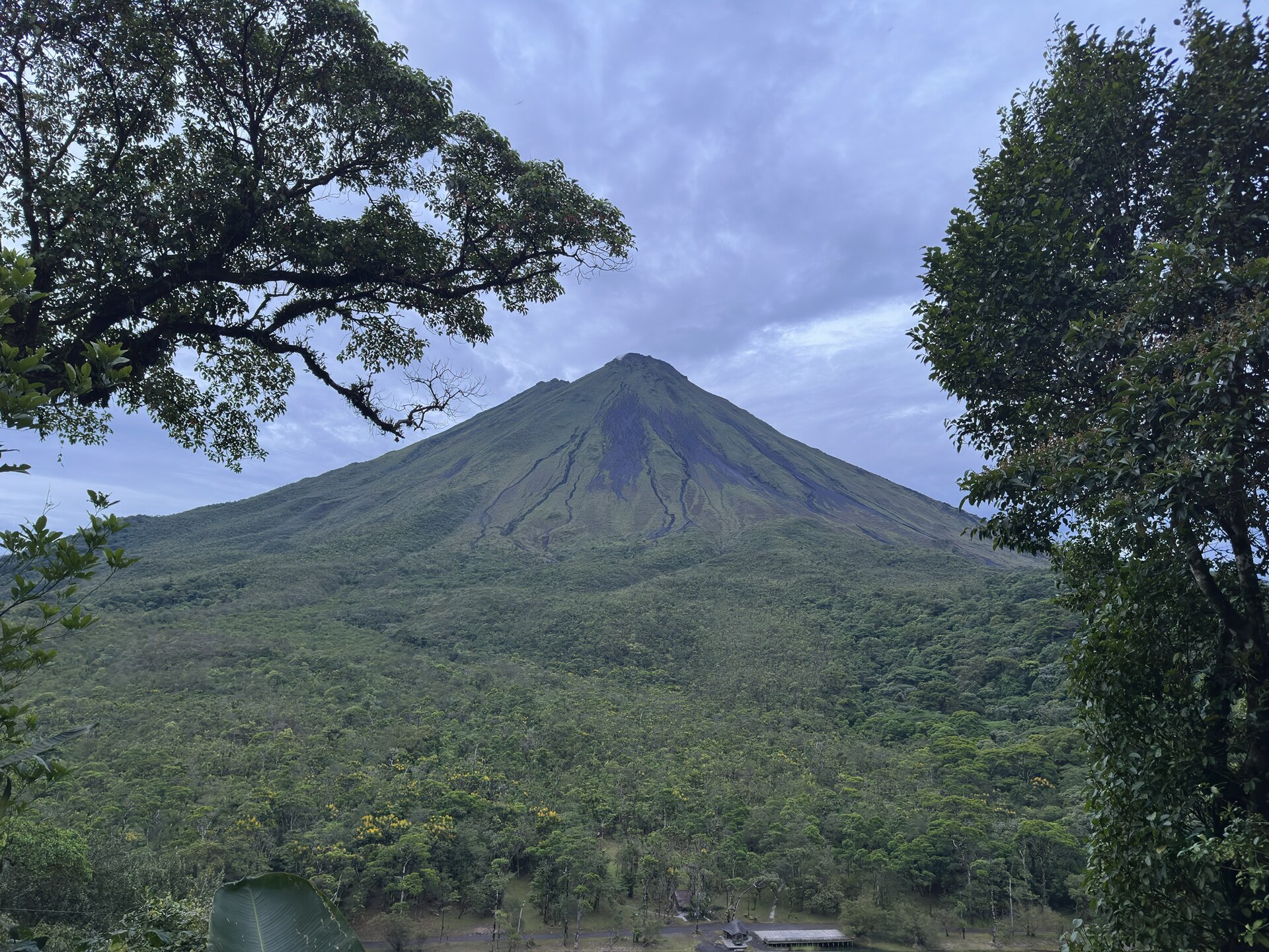
Arenal Volcano National Park
Parque Nacional Volcán Arenal
Added by
Anonymous Curator
Reviewed by
Under Review
Last modified by
Julia Trouin
Description
Home to Costa Rica's most iconic volcano with its near-perfect cone. The park offers spectacular views of the colossus, hikes over ancient lava flows, and the chance to explore the vibrant rainforest that was reborn after the devastating 1968 eruption.
ClassificationAdministrative and legal categories that govern how this area is managed and protected.
HistoryHistorical background, founding story, and timeline of legal protection designation.
The Arenal Volcano lay dormant for hundreds of years until its sudden and destructive eruption in July 1968, which buried the towns of Pueblo Nuevo and Tabacon. The park was created in 1991 to protect the invaluable water recharge zone of the Lake Arenal basin and the complex volcanic ecosystem.
Surface AreaTotal surface area subdivided by terrestrial, marine, and buffer zones in hectares.
Entry FeesEntry fee structure for Costa Rican residents and international visitors, in CRC and USD.
Payment is made by debit or credit card at the entrance booths of both sectors (Volcano Sector and Peninsula Sector). The ticket is valid to visit both sectors on the same day.
EcosystemsVegetation communities and ecosystem types present within this protected area.
The park encompasses premontane rainforest and low-elevation cloud forest. It features a stark contrast: the western slope of the volcano is rugged and covered in lava rocks, while the eastern slope is covered in dense, humid tropical forest. It also includes riparian ecosystems and the adjacent Lake Arenal.
WildlifeNotable fauna and flora documented through scientific surveys and long-term monitoring.
Exceptional biodiversity including tapirs, sloths, anteaters, three monkey species (howler, white-faced, spider), and large felines. It is a prime destination for observing keel-billed toucans, oropendolas, hummingbirds, and an immense variety of orchids and ferns.
How to Get ThereHow to reach this protected area by road, public bus, boat, or guided tour.
Located 15 km from La Fortuna de San Carlos, along the road bordering the volcano towards Lake Arenal (Route 142). The road is fully paved. The park has two main access sectors: the Volcano Sector (the main lava flows) and the Peninsula Sector (bordering Lake Arenal).
ClimateTypical weather patterns, temperature ranges, and seasonal rainfall affecting this location.
Humid rainforest climate. Constant temperatures year-round between 21°C and 28°C. Highly influenced by Caribbean winds. Rain is frequent throughout the year (over 3500mm annually). September and October often have clearer mornings to view the volcanic cone.
Visitor RegulationsVisitor rules and restrictions designed to protect the natural heritage of this area.
STRICTLY PROHIBITED to ascend towards the crater via unauthorized trails; the volcano emits toxic gases, has very unstable slopes, and poses a risk of fatal falls. Leaving marked trails, extracting volcanic rocks, flying drones without permission, and bringing pets are prohibited.
Best Seasons to Visit
Regions
Facilities & ServicesInfrastructure and services available: ranger stations, restrooms, parking, and lodges.
HighlightsDistinctive features and attractions that make this protected area exceptional.
Main ThreatsDocumented pressures reducing the population: habitat loss, hunting, disease, climate change, and invasive species.
- Ingreso de turistas ilegales con guías piratas hacia zonas de alto riesgo en el cráter
- Extracción de orquídeas y fauna
- Desarrollo urbano masivo en los bordes del parque
ConservationActive programs and initiatives working to protect and restore this habitat or area.
- Operativos conjuntos con la Fuerza Pública para interceptar ascensos ilegales
- Restauración de zonas de amortiguamiento y educación con el sector hotelero local
- Monitoreo constante de actividad volcánica con OVSICORI