
Los Quetzales National Park
Parque Nacional Los Quetzales
Added by
Anonymous Curator
Reviewed by
Under Review
Last modified by
Julia Trouin
Description
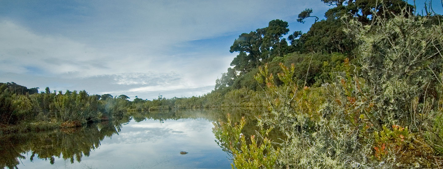
A mystical cloud forest sanctuary located in the highlands of the Talamanca Mountain Range. It is world-renowned as one of the most important sites for spotting the resplendent quetzal, offering landscapes of centuries-old oaks covered in moss and unique high-altitude biodiversity.
ClassificationAdministrative and legal categories that govern how this area is managed and protected.
HistoryHistorical background, founding story, and timeline of legal protection designation.
Established in 2005, the park was created by upgrading a portion of the former Los Santos Forest Reserve. Its primary goal was to protect the quetzal's breeding habitat and ensure biological connectivity of high-altitude forests that act as water sponges for the Savegre and Naranjo river basins.
Surface AreaTotal surface area subdivided by terrestrial, marine, and buffer zones in hectares.
Entry FeesEntry fee structure for Costa Rican residents and international visitors, in CRC and USD.
Mandatory card payment. Reservations can be made through the SINAC web platform. Arriving early is recommended for birdwatching.
EcosystemsVegetation communities and ecosystem types present within this protected area.
It primarily protects cloud forest, montane rainforest, and subalpine paramo. It is characterized by the presence of massive oak groves (Quercus spp.) and a high density of epiphytes, ferns, and shrubs of the Ericaceae family that provide food for birds.
WildlifeNotable fauna and flora documented through scientific surveys and long-term monitoring.
It is the emblematic home of the Resplendent Quetzal (Pharomachrus mocinno). Black-faced solitaires, emerald toucanets, fiery-throated hummingbirds, and highland guans are also observed. Among mammals, tapirs, coyotes, and ocelots can be found.
How to Get ThereHow to reach this protected area by road, public bus, boat, or guided tour.
Located 76 km south of San Jose via the South Inter-American Highway (Route 2). The main entrance is in the Ojo de Agua sector. Access is via paved road, suitable for all types of vehicles.
ClimateTypical weather patterns, temperature ranges, and seasonal rainfall affecting this location.
High mountain climate, cold and very humid. Temperatures range between 5°C and 18°C. The dry season (January-April) coincides with the quetzal's nesting season, being the best time for observation.
Visitor RegulationsVisitor rules and restrictions designed to protect the natural heritage of this area.
Mandatory to stay on the trails to avoid damaging the fragile cloud forest soil. Prohibited to collect plants or fungi. Use of specialized guides for birdwatching is recommended. Due to the cold, warm and waterproof clothing is necessary.
Best Seasons to Visit
Regions
Facilities & ServicesInfrastructure and services available: ranger stations, restrooms, parking, and lodges.
HighlightsDistinctive features and attractions that make this protected area exceptional.
Main ThreatsDocumented pressures reducing the population: habitat loss, hunting, disease, climate change, and invasive species.
- Cacería ilegal
- Incendios forestales
- Fragmentación del hábitat fuera del parque
ConservationActive programs and initiatives working to protect and restore this habitat or area.
- Protección del corredor biológico Savegre
- Monitoreo del Quetzal
- Educación ambiental con comunidades locales