
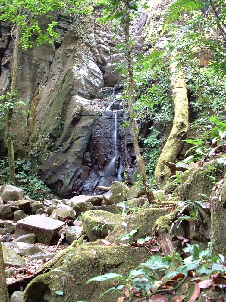
Rincon de la Vieja National Park
Parque Nacional Volcán Rincón de la Vieja
Added by
Anonymous Curator
Reviewed by
Under Review
Last modified by
Julia Trouin
Description
A spectacular active volcanic park offering a surreal immersion into the Earth's geothermal energy. It features fumaroles, boiling mud pots, sulfur lagoons, and an active volcano, all surrounded by an intricate network of crystal-clear waterfalls and dense transitional forests.
ClassificationAdministrative and legal categories that govern how this area is managed and protected.
HistoryHistorical background, founding story, and timeline of legal protection designation.
Created in 1973, it protects the country's most voluminous volcanic massif (with 9 distinct craters). Its name comes from an old local legend about an old woman (the 'vieja') who lived on the slopes (the 'rincón') of the volcano. It is vital for protecting the province's watersheds, feeding 32 rivers.
Surface AreaTotal surface area subdivided by terrestrial, marine, and buffer zones in hectares.
Entry FeesEntry fee structure for Costa Rican residents and international visitors, in CRC and USD.
Tickets must be purchased in advance on the SINAC web platform. Physical tickets are not sold at the entrance booth. Note: The Las Pailas Sector is CLOSED on Mondays for maintenance.
EcosystemsVegetation communities and ecosystem types present within this protected area.
It divides the waters to the Caribbean and the Pacific, creating extreme contrasts. The Las Pailas Sector (Pacific) consists of tropical transitional and dry forests. The Santa Maria Sector features tropical humid forest. The upper slopes are covered by low, twisted cloud forest blanketed in epiphytes.
WildlifeNotable fauna and flora documented through scientific surveys and long-term monitoring.
A vital refuge for felines (pumas, jaguars, ocelots), tapirs, two-toed sloths, and three monkey species. It is a birdwatching paradise with over 300 species, including the emerald toucanet, guans, motmots, and the emblematic great curassow. Furthermore, the Guaria Morada, the national flower, blooms abundantly here.
How to Get ThereHow to reach this protected area by road, public bus, boat, or guided tour.
Accessed primarily from Liberia (approx. 25 km). It has two entrance sectors: Las Pailas (the most popular and accessible, paved road and a stretch of well-maintained gravel) and Santa Maria (requires a 4x4, more rugged access).
ClimateTypical weather patterns, temperature ranges, and seasonal rainfall affecting this location.
In Las Pailas, the climate is hot (26°C to 29°C) and sunny, especially from December to April. In Santa Maria and higher elevations, it is cool and very humid year-round. Strong trade winds blow in summer, moving the cloud cover.
Visitor RegulationsVisitor rules and restrictions designed to protect the natural heritage of this area.
The trail to the active crater is often closed due to toxic gases and eruptive activity (check with SINAC). It is mandatory to stay on trails in the mud pots area to avoid severe thermal burns. Extracting resources, bathing in hot springs within the park (spas are available outside), and feeding wildlife are prohibited.
Best Seasons to Visit
Regions
Facilities & ServicesInfrastructure and services available: ranger stations, restrooms, parking, and lodges.
HighlightsDistinctive features and attractions that make this protected area exceptional.
Main ThreatsDocumented pressures reducing the population: habitat loss, hunting, disease, climate change, and invasive species.
- Erupciones freáticas y gases tóxicos (riesgo geológico)
- Extracción ilegal de flora (especialmente orquídeas) y caza
- Incendios forestales en la zona seca
- Desarrollo desordenado fuera de los límites del parque
ConservationActive programs and initiatives working to protect and restore this habitat or area.
- Monitoreo vulcanológico constante en alianza con OVSICORI
- Restauración de bosques en el límite con el sector seco
- Programa de control de incendios forestales del ACG
- Educación ambiental con comunidades aledañas