
Tapantí – Macizo de la Muerte National Park
Parque Nacional Tapantí – Macizo de la Muerte
Added by
Anonymous Curator
Reviewed by
Under Review
Last modified by
Julia Trouin
Description
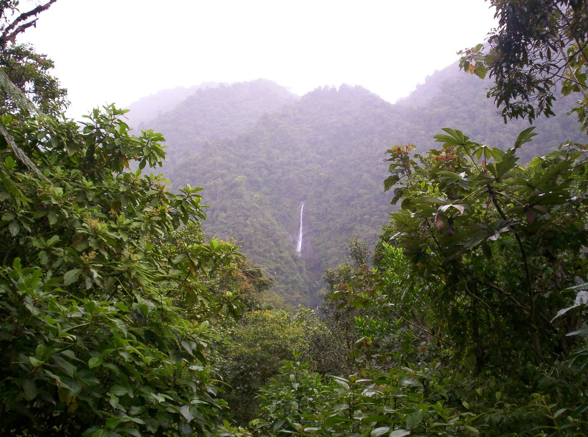
Tapantí – Macizo de la Muerte National Park is the rainiest protected wilderness in Costa Rica and one of the wettest in the Americas. Nestled in the foothills of the Talamanca Mountain Range in Cartago Province, it safeguards more than 58,000 hectares of cloud forest, montane rainforest, and subalpine páramo. Its streams and rivers feed the Cachí Reservoir, supplying a significant share of the country apos;s hydroelectric output. The extraordinary richness of its ecosystems makes it a premier biological repository, harboring hundreds of species of birds, mammals, amphibians, and vascular plants, many endemic or threatened. A perpetually misty atmosphere, waterfalls cascading through tree ferns, and the green twilight of its canopy compose a landscape of exceptional beauty, accessible only on foot along well-maintained but demanding trails.
ClassificationAdministrative and legal categories that govern how this area is managed and protected.
HistoryHistorical background, founding story, and timeline of legal protection designation.
The history of protection for the Tapantí area dates back to 1945, when the Costa Rican government acknowledged the strategic importance of its water system for the supply of drinking water to the Greater Metropolitan Area and for electricity generation. In 1966 the Tapantí Forest Reserve was established, with the primary purpose of protecting the watersheds that feed the Cachí hydroelectric project, operated by the Costa Rican Electricity Institute (ICE). National park status was granted in 1982, broadening the territory legal protection. The most significant expansion occurred in 1997 and 1998, when the Macizo de la Muerte sector was incorporated, raising the total area to more than 58,000 hectares and consolidating the biological corridor connection with La Amistad International Park. This merger recognized that the two units shared not only geographical continuity but also an inseparable ecological function: the protection of the complete altitudinal gradient of the Caribbean slope of the Talamanca Range.
Surface AreaTotal surface area subdivided by terrestrial, marine, and buffer zones in hectares.
Entry FeesEntry fee structure for Costa Rican residents and international visitors, in CRC and USD.
Fees set by SINAC, subject to change. Children under 6 enter free. Discounts for students and academic groups with valid ID. Cash payment only at the entrance booth.
EcosystemsVegetation communities and ecosystem types present within this protected area.
Tapantí spans an altitudinal range from 800 meters above sea level in the lowest valleys to 3,491 meters at the summits of the Macizo de la Muerte, allowing the coexistence of at least four major ecosystem types. In the lower zones, premontane rainforest dominates, with trees reaching 40 meters in height, high-density epiphytes, and crystal-clear fast-flowing rivers. As elevation increases, lower montane rainforest takes over, characterized by abundant tree ferns of the genera Cyathea and Dicksonia, mosses blanketing virtually every available substrate, and perpetual mist filtering sunlight into golden and green hues. Above 2,000 meters, upper cloud forest features shorter trees whose bark is smothered in thick layers of mosses, lichens, and epiphytic orchids. At the highest elevations, high-altitude páramos and grasslands develop, dominated by bamboo grasses of the genus Chusquea and rosette plants. Annual rainfall between 5,000 and 8,000 millimeters falls in the wettest zones with no defined dry season.
WildlifeNotable fauna and flora documented through scientific surveys and long-term monitoring.
The wildlife of Tapantí National Park is extraordinarily rich, favored by altitudinal variation and permanent water availability. Among birds, the resplendent quetzal (Pharomachrus mocinno) is notable, using the upper sectors for nesting from February to June. Other species include the harpy eagle (Harpia harpyja) as an occasional visitor, the collared aracari (Pteroglossus torquatus), the black-faced solitaire (Myadestes melanops), the three-wattled bellbird (Procnias tricarunculata), and more than 260 additional species. Mammals include Baird tapir (Tapirus bairdii), jaguar (Panthera onca), puma (Puma concolor), ocelot (Leopardus pardalis), white-nosed coati (Nasua narica), and collared peccary (Pecari tajacu). Herpetofauna features glass frogs (Centrolenidae), salamanders of genus Bolitoglossa, and the fer-de-lance (Bothrops asper). Streams harbor introduced rainbow trout (Oncorhynchus mykiss) and native guapote cichlid (Parachromis dovii). Epiphytic vegetation includes hundreds of orchid, bromeliad, and aroid species.
How to Get ThereHow to reach this protected area by road, public bus, boat, or guided tour.
The main access to Tapantí National Park is from the city of Cartago, taking the route toward Paraíso and then toward Orosi. From the center of Orosi, a paved road continues for approximately 8 kilometers to the official park entrance, crossing the picturesque Orosi Valley. The total distance from San José is approximately 60 kilometers, taking between 1 hour 15 minutes and 1 hour 45 minutes depending on traffic. A private vehicle is essential, preferably four-wheel drive during the rainy season. A taxi service from Orosi can be arranged directly. Early morning arrival, ideally before 8:00 a.m., is strongly recommended.
ClimateTypical weather patterns, temperature ranges, and seasonal rainfall affecting this location.
Tapantí is one of the rainiest places in Costa Rica, with annual precipitation of 5,000 to 8,000 mm and no defined dry season. Temperatures range from 12 °C to 22 °C in the middle sectors and drop below 8 °C in páramo zones. Relative humidity is permanently high. Waterproofs and warm clothing are always recommended regardless of the season. The heaviest rains typically occur between May and November with frequent afternoon downpours.
Visitor RegulationsVisitor rules and restrictions designed to protect the natural heritage of this area.
Access is governed by SINAC regulations and ACLA-C provisions. Pets are strictly prohibited, as is collecting plants, seeds, rocks, or animals. Open fires outside designated areas are not permitted. Fishing requires a valid license and only catch-and-release is allowed in designated zones. Camping is prohibited. Drone use requires prior written authorization from SINAC. Visitors must remain on marked trails at all times. Groups of more than 12 people may require prior notification.
BiodiversitySpecies count statistics from scientific surveys and long-term monitoring programs.
TrailsMarked hiking trails open to visitors, including the total network distance in kilometres.
Best Seasons to Visit
Regions
Facilities & ServicesInfrastructure and services available: ranger stations, restrooms, parking, and lodges.
HighlightsDistinctive features and attractions that make this protected area exceptional.
Main ThreatsDocumented pressures reducing the population: habitat loss, hunting, disease, climate change, and invasive species.
- HIGH
- MEDIUM
- HIGH
- MEDIUM
ConservationActive programs and initiatives working to protect and restore this habitat or area.
- SINAC / UCR
- SINAC / MINAE
- ICE / SINAC
- Universidad de Costa Rica
Additional DataSupplementary data that does not fit the standard classification fields.
- watershed_protection
- hydroelectric_relevance
- sister_protected_areas
Comments & NotesInternal notes and observations added by curators during the review process.
- 2026-06
- 2026-06
Bibliographic ReferencesScientific publications, field guides, and databases that document this species or area.
- Obando, V. (2002). Biodiversidad en Costa Rica: Estado del conocimiento y gestión. INBio / MINAE.
- Stiles, F. G. & Skutch, A. F. (1989). A Guide to the Birds of Costa Rica. Cornell University Press.
- Savage, J. M. (2002). The Amphibians and Reptiles of Costa Rica. University of Chicago Press.
- SINAC (2014). Plan de Manejo Parque Nacional Tapantí – Macizo de la Muerte. MINAE.
- Holdridge, L. R. (1967). Life Zone Ecology. Tropical Science Center, San José, Costa Rica.