
Tenorio Volcano National Park
Parque Nacional Volcán Tenorio
Added by
Anonymous Curator
Reviewed by
Under Review
Last modified by
Julia Trouin
Description
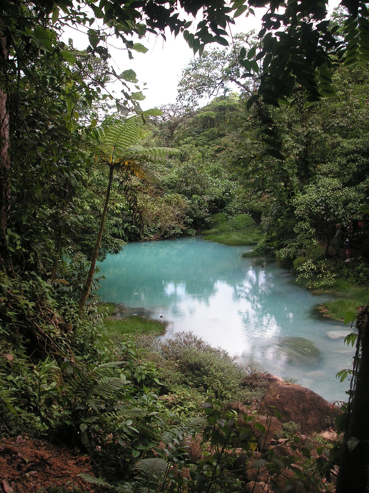
Home to the world-famous Rio Celeste, a natural optical phenomenon where the waters turn an intense turquoise when two rivers rich in volcanic minerals mix. The park protects the Tenorio volcano massif, offering trails through dense rainforest, views of the imposing sky-blue waterfall, lagoons of unreal colors, and bubbling hot spring fumaroles.
ClassificationAdministrative and legal categories that govern how this area is managed and protected.
HistoryHistorical background, founding story, and timeline of legal protection designation.
Created in 1995 to protect the volcanic massif and the important watersheds that feed the northern part of the country. A local indigenous legend says that God washed his brushes in the river after painting the sky, giving it its characteristic color. Science later proved that the sky-blue color is an optical effect produced by the scattering of sunlight due to aluminosilicates suspended in the water.
Surface AreaTotal surface area subdivided by terrestrial, marine, and buffer zones in hectares.
Entry FeesEntry fee structure for Costa Rican residents and international visitors, in CRC and USD.
Ticket purchase EXCLUSIVELY online through the SINAC portal. Access is restricted to a maximum number of visitors per day, so during high season it must be booked weeks in advance.
EcosystemsVegetation communities and ecosystem types present within this protected area.
Dominated by premontane rainforest and cloud forest in the highlands. The park is a tapestry of constant greenery thanks to the high rainfall. The soils are heavily influenced by volcanic activity, rich in minerals that, when interacting with the waters of the Buena Vista and Quebrada Agria rivers, create the chemical environment generating the color of Rio Celeste.
WildlifeNotable fauna and flora documented through scientific surveys and long-term monitoring.
It is a common refuge for the Baird's tapir, pumas, ocelots, tayras, and howler and white-faced monkeys. The humidity of the forest favors multiple amphibian species, such as the famous glass frog and the strawberry poison-dart frog. Among the birds, the umbrellabird, bellbird, toucans, and various trogon species stand out.
How to Get ThereHow to reach this protected area by road, public bus, boat, or guided tour.
The main entrance is through the El Pilon Sector, accessible from the route through Bijagua (Upala) or Guatuso. The road to the entrance is paved and in good condition for any vehicle. There is private parking right outside the entrance booth.
ClimateTypical weather patterns, temperature ranges, and seasonal rainfall affecting this location.
Rainy and cool climate (15°C to 24°C). It rains constantly throughout the year. ATTENTION: Heavy rains can temporarily muddy the Rio Celeste, making it lose its characteristic blue color. To see the river at its best, the driest season (February to April) is most recommended.
Visitor RegulationsVisitor rules and restrictions designed to protect the natural heritage of this area.
STRICTLY PROHIBITED TO SWIM in any part of the river inside the national park to avoid altering the natural chemicals of the water or affecting flora and fauna. The trail includes areas with many stairs and dirt sections that become muddy with rain; closed shoes or rubber boots are essential (available for rent outside the park). Leaving the trails is prohibited.
Best Seasons to Visit
Regions
Facilities & ServicesInfrastructure and services available: ranger stations, restrooms, parking, and lodges.
HighlightsDistinctive features and attractions that make this protected area exceptional.
Main ThreatsDocumented pressures reducing the population: habitat loss, hunting, disease, climate change, and invasive species.
- Saturación turística en temporada alta
- Ingreso ilegal para bañarse en el río
- Erosión severa de senderos por alta pluviosidad
ConservationActive programs and initiatives working to protect and restore this habitat or area.
- Regulación estricta de aforo y compra online
- Prohibición total de baño para proteger la química del agua
- Mantenimiento intensivo e impermeabilización de senderos