
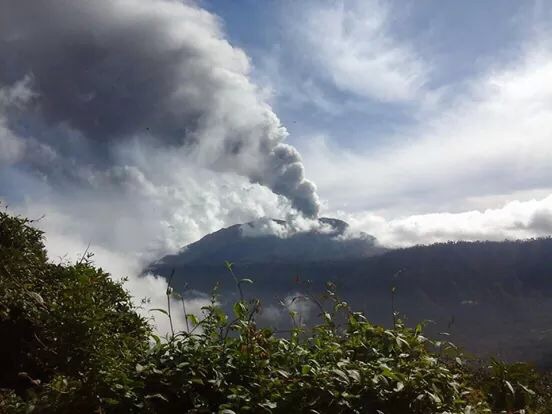
Turrialba Volcano National Park
Parque Nacional Volcán Turrialba
Added by
Anonymous Curator
Reviewed by
Under Review
Last modified by
Julia Trouin
Description
An active colossus dominating the eastern horizon of the Central Valley. It is known for its constant gas and ash activity, and for harboring unique high-altitude ecosystems where cloud forest merges with subalpine paramo in a rugged and wild environment.
ClassificationAdministrative and legal categories that govern how this area is managed and protected.
HistoryHistorical background, founding story, and timeline of legal protection designation.
Established in 1955 along with other volcanoes in the mountain range. After decades of relative calm, the volcano began a major new eruptive cycle in 2010, forcing prolonged closures to protect visitors. It has recently reopened under strict safety and volcanic monitoring protocols.
Surface AreaTotal surface area subdivided by terrestrial, marine, and buffer zones in hectares.
Entry FeesEntry fee structure for Costa Rican residents and international visitors, in CRC and USD.
Tickets available only through the SINAC web platform. Guide service is mandatory for certain trails and carries an additional cost.
EcosystemsVegetation communities and ecosystem types present within this protected area.
It features zoning that includes montane rainforest and subalpine paramo. Vegetation near the craters is sparse and adapted to acid rain, while the lower slopes retain dense forests covered in mosses, ferns, and epiphytes.
WildlifeNotable fauna and flora documented through scientific surveys and long-term monitoring.
Despite the volcanic activity, coyotes, forest rabbits, and various high-altitude birds can be observed. It is an important site for spotting paramo species and raptors taking advantage of the thermal currents generated by the volcano.
How to Get ThereHow to reach this protected area by road, public bus, boat, or guided tour.
Accessed from the city of Cartago towards the town of Pacayas or via the Santa Cruz de Turrialba route. The final road to the entrance area is steep and narrow. Due to volcanic activity, access is controlled, and a high-clearance 4x4 vehicle is recommended for the last few kilometers.
ClimateTypical weather patterns, temperature ranges, and seasonal rainfall affecting this location.
Cold and windy climate with temperatures between 4°C and 18°C. Conditions change rapidly; the volcano is usually clear in the mornings during the dry season.
Visitor RegulationsVisitor rules and restrictions designed to protect the natural heritage of this area.
Entry is exclusively with prior reservation. Wearing a safety helmet is mandatory, and park rangers' instructions must be followed. Descending into the craters, extracting ash or volcanic rocks, and bringing pets are prohibited. The park closes immediately upon changes in seismicity or gas levels.
Best Seasons to Visit
Regions
Facilities & ServicesInfrastructure and services available: ranger stations, restrooms, parking, and lodges.
HighlightsDistinctive features and attractions that make this protected area exceptional.
Main ThreatsDocumented pressures reducing the population: habitat loss, hunting, disease, climate change, and invasive species.
- Actividad volcánica eruptiva
- Gases tóxicos
- Erosión severa de caminos de acceso
ConservationActive programs and initiatives working to protect and restore this habitat or area.
- Monitoreo vulcanológico en tiempo real (OVSICORI)
- Plan de seguridad para visitantes ante erupciones
- Conservación de especies de páramo de altura